the toughest journeys!


Gridone
Mount Gridone, also called Ghiridone and Limidario, is the highest of the mountains that surround the Maggiore lake. The tour described here climbs the Swiss side and goes down on the Italian side. On both sides the paved roads stops far away from the summit; the rest of the tour follow alpine pathways.
Route
Brissago - Mergugno - Gridone - Spoccia- Cannobio - Brissago
Description
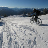
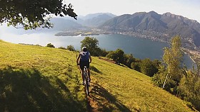
There are a few roads that climbs the lowest part of Gridone. The easiest is the one that starts in Brissago and takes to Incella and Monti di Mergugno (1050 m). With a length of 8 km and an average slope at 10%, it's very popular among the road bikers of the region.
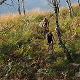
The road ends in Mergugno. Here road bikers turn around and start the descent, but mountain bikers have just reached the beginning of the adventure. Following the hiking signs you can take the nice single-track that climbs in the sacred wood of Brissago. The first third of the trail is partly rideable, even though it's pretty tough, then it gets steeper and the MTB has to be carried up to Rifugio Al Legn (1804 m).
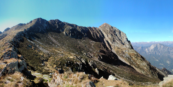
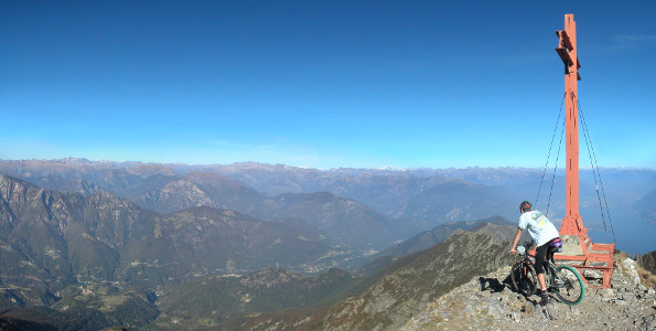
Past the refuge you climb towards Bocchetta di Valle (1948 m), where many pathways merge together. From here you can finally see the Gridone's summit with its big orange cross. To get there you still have to climb two steep chimneys, that are pretty hard to overcome having the carry the bike. Once you get to the summit, just hope there's noone around, 'cause people would just think you're crazy. And they'd be right.
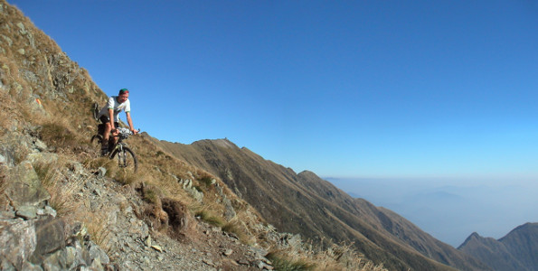
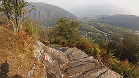
After the effort of the climb, the descent will pay you back for all the suffering, but it will cause new and more terrible ones. It begins by following the ridge towards the west; the route is marked in yellow-red. After less than a mile you leave the ridge and you begin to descend diagonally to the south. The trail is pretty tight, but in might partly be ridden by bikers with good technical skills, obviously proceeding with caution and avoiding falling into the valley. However, there are many sections where you will have top walk.
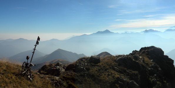
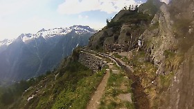
After Bocchetta del Fornale (2034 m, placed over the source with the same name), the path moves to the wide southern ridge and becomes increasingly smooth and enjoyable. At 1600 m you will meet the first farmhouse, the silent and crumbling Alpe la Quadra, followed by the meadows of Alpe Spoccia. While we slowly get closer to civilization, the narrow path turns into a comfortable double-track, and your arms will turn into a tremulous pudding.
At an altitude of 1334 m you come to a bifurcation. On the left a steep dirt road passes through the airy pastures of Olzeno and drops to Gurrone (697 m), where, following the main road, you can quickly reach Cannobio. This is the descent that would be chosen by any sane person, but since at this moment smart person are quietly lying in the garden of their home licking an ice cream, you are free to choose the hard way: the path on the right. Initially it is quite smooth and leads to the small village of Bronte. Through rather steep woods and clearings that require very good driving skills, it leads to the Rio Secco Bridge: past the bridge you have to reach Spoccia (798 m) thank to a partly unrideable path. From Spoccia is easy to reach the main road of the Cannobina valley, which takes you back to the Verbano Lake, where you can take the main road to Brissago.
Latest updates:
Follow me on:


